Park nearby Drëps
Luxembourg
Park nearby Drëps
Drëps
30, Rue du Baerendall, 8250, Mamer, Capellen, LU Luxemburgo
contacts phone
:
+352
website:
www.mamer.lu
Latitude:
49.6420206
, Longitude:
6.0427829
larger map & directions
read more
nearest Park
1.723 km
Fraiheetsbam (forêt entre Strassen et Bridel)
Strassen
Park
read more
2.275 km
Parc Brill
12 Rue Bellevue, Mamer
Park
read more
3.503 km
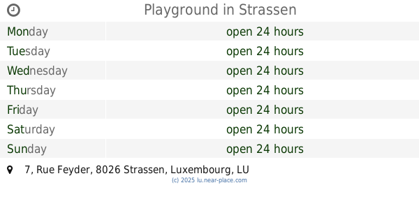
Playground
7 Rue Feyder, Strassen
Park
read more
4.613 km
Park Bertrange
5 Rue Pletzer, Bertrange
Park
read more
4.763 km
Smal Fountain with Benches
Mamer
Park
read more
5.643 km
Schrebergarten Merl
58 Rue des Celtes, Luxembourg
Park
read more
5.706 km
Monument aux Morts
141-143 Rue de Merl, Luxembourg
Park
read more
6.044 km
The Tree Hub
23 Rue Charles Arendt, Luxembourg
Park
read more
6.289 km
Park Leir
Steinsel
Park
read more
6.324 km
Kids Playground
Luxembourg City
Park
read more
6.387 km
Merl-Belair
Luxembourg City
Park
read more
6.555 km
Alzette renaturée Walferdange
28 Rue de l'Alzette, Helmsange
Park
read more
6.814 km
Parc Fondation Pescatore
13 Avenue Jean-Pierre Pescatore, Luxembourg
Park
read more
7.163 km
Square Robert Brasseur
Côté d'Eich, Luxembourg
Park
read more
7.247 km
Parc de Cessange
Cessange
Park
read more
7.484 km
Jardinage Bonert
165 Rue de Kirchberg, Luxembourg
Park
read more
7.727 km
Outdoor fitness park
Luxembourg, 2 Rue Saint-Quirin, Luxembourg
Park
read more
7.858 km
Placebo Sàrl
41 Avenue de la Gare, Luxembourg
Park
read more
7.903 km
Mansfield Park
Allée Pierre de Mansfeld, Luxembourg
Park
read more
8.085 km
urBOgarden
62 Rue de Bonnevoie, Luxembourg
Park
read more
10.995 km
Wäschbur
38 Rue Principale, Saeul
Park
read more
12.559 km
Parc Molter
Parc Molter, 3945, Mondercange
Park
read more
14.972 km
Wasserturm-Bettemburg
Rue Jean Wolter, Bettembourg
Park
read more
15.083 km
Maisons et Jardins Sàrl
31 rte de Luxembourg, Pétange
Park
read more
17.213 km
MSA International S.A.
PED - Avenue de l'Europe, Lamadelaine
Park
read more
📑
all categories
Accounting
Administrative area level 1
Administrative area level 2
Airport
Amusement park
Aquarium
Art gallery
Atm
Bakery
Bank
Bar
Beauty salon
Bicycle store
Book store
Bowling alley
Bus station
Cafe
Campground
Car dealer
Car rental
Car repair
Car wash
Casino
Cemetery
Church
City hall
Clothing store
Colloquial area
Convenience store
Courthouse
Dentist
Department store
Doctor
Electrician
Electronics store
Embassy
Establishment
Finance
Fire station
Florist
Food
Funeral home
Furniture store
Gas station
General contractor
Grocery or supermarket
Gym
Hair care
Hardware store
Health
Home goods store
Hospital
Insurance agency
Jewelry store
Laundry
Lawyer
Library
Light rail station
Liquor store
Local government office
Locality
Locksmith
Lodging
Meal delivery
Meal takeaway
Mosque
Movie rental
Movie theater
Moving company
Museum
Natural feature
Neighborhood
Night club
Painter
Park
Parking
Pet store
Pharmacy
Physiotherapist
Place of worship
Plumber
Point of interest
Police
Political
Post office
Premise
Real estate agency
Restaurant
Roofing contractor
Route
Rv park, camping
School
Shoe store
Shopping mall
Spa
Stadium
Storage
Store
Subpremise
Supermarket
Synagogue
Taxi stand
Train station
Transit station
Travel agency
University
Veterinary care
Zoo
sublocality level 1
↑